| The Full Story (cont.) Part 4. |
| A
trip to the Albert 1er hut.
A little known fact.
(Click for photo page and short account.)
Source of the Arve
A short cut
Chattering Italians
"Bees this high up ?"
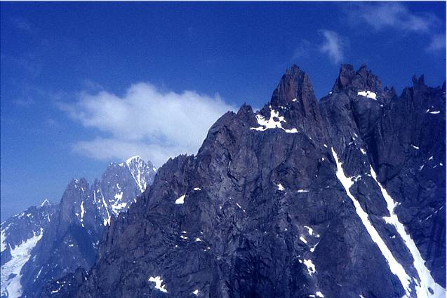
The legendary Forbes Arête
Some more views (1975
from Chardonnet) :
Once more up to the Aiguilles
"Viagra, anyone?"
Abuse of artificial means
A pricey ride
Where have all the butterflies gone?
Graham in fine form
Back to the Biolay
We'll meet again..... |
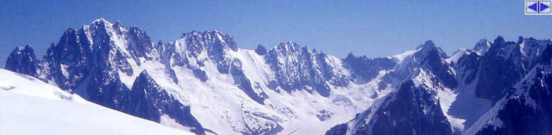
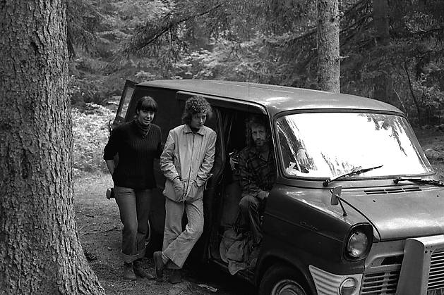
In reality, it was probably just a few days before the forecast promised fine weather for the next day or two and we all decided to take the tranny (Was is der Tranny?) to the top village of the valley, Le Tour. This is the starting point for another of the larger French huts, the Refuge Albert 1er, named, funnily enough, after King Albert 1er, "Roi des Belges" from 1909 to 1934, and not an aristocrat from Savoy itself. He was apparently a keen visitor to Chamonix but met his death in a rock climbing accident in Belgium, of all places. It happened on a cliff next to the River Meuse, which is only about 100 metres high, and in the photos, looks a bit like the Avon gorge, a strange destiny. This end of the valley is quite different, being
considerably higher than Chamonix. Le Tour itself is at 1,450 m. From
the car park to the hut the path is entirely through open ground, there
are no friendly pine trees to provide the shade we had grown accustomed
to on the various paths up behind the Biolay. We had soon formed a long
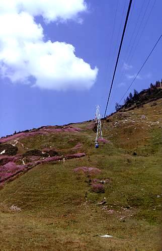
straggly file, zigzagging up the wide track over what must be good ski
slopes in winter. There is a ski lift which can be used to reduce the
effort, but, as you will have realized by now, we had a quasi-religious
aversion to such soft options that went beyond our financial situation,
wartime puritanism was still hard at work within us. A steep track heads up towards the Col de Balme, the
Swiss border, and the source of the River Arve which we had followed on
the drive up, from Geneva where it joins the Rhône, then Bonneville, St
Gervais and Chamonix. Before the col, you turn sharply right to traverse
back across towards the glacier and then up an easier path along the
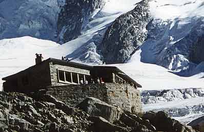
hillside until, after a few zigzags, the hut can be seen, just above the
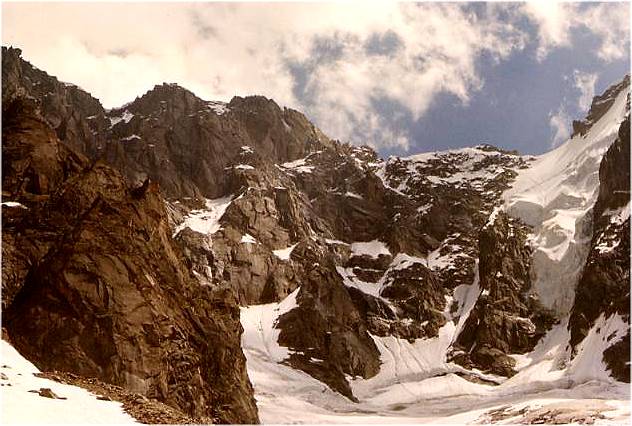
icefall, on the same level as the upper plateau of the glacier. There is
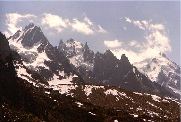
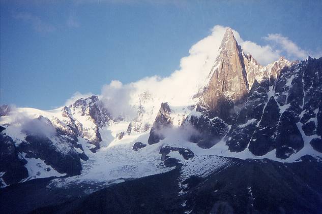
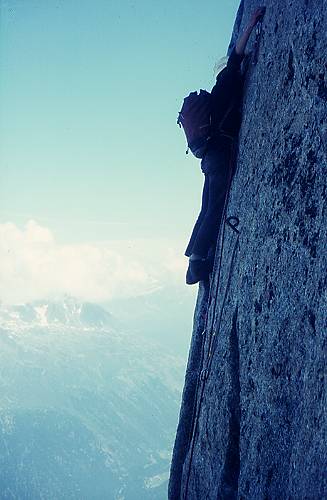
a harder path, straight up the lateral moraine
(on the left in photo) from the hut to the
valley, which is used mostly for descent. Some years after, I left the
hut a bit late and we were caught by nightfall on this broken ridge of
glacier grit. The state of the path, and with no light, as our batteries
were completely flat, made us prefer to spend a very cold, dusty night
sleeping on the spot, without sleeping bags, rather than carry on down
in the dark. This gives you an idea of just how broken it is. Again the hut was crowded, and sleeping difficult, but
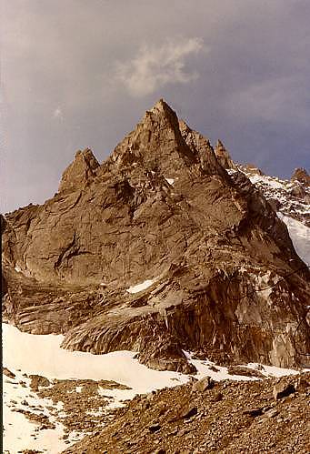
the weather was fine and the next morning we set off across the easy
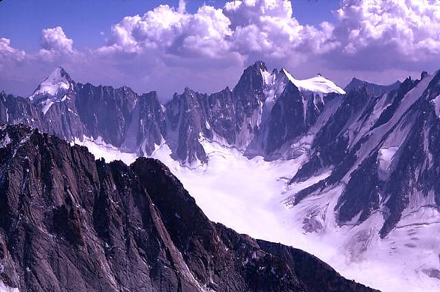
angled glacier to the Aiguille Purtscheller, which we climbed by the
South Ridge, a pleasant AD rock route on good sound granite. There are
several similar rock peaks in the area, all elegant pyramids, which
stand out well from a vast expanse of snow covered glacier plateau. We
climbed another, the Aiguille du Tour, the next day. The area seems to be much frequented by large groups of
Italians from just across the border. They can be heard miles off as
they chatter and joke in characteristic fashion. Graham, one of the
gruffer of the gruff Northerners, tried to communicate to them his
desire for a bit of quiet, but apparently they did not understand his
sourly remarks as they just waved and smiled and carried on with their
gay banter. As we came down to the snow from the Aiguille
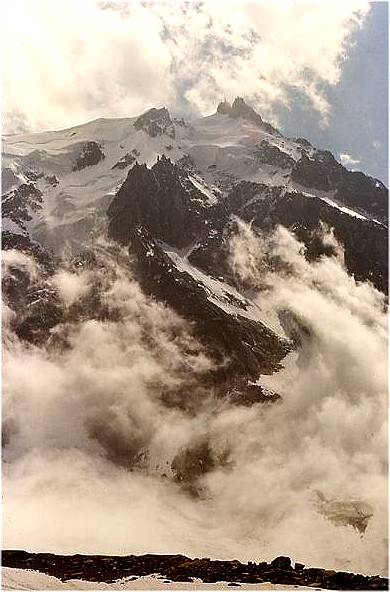
Purtscheller, the weather clouded over and we soon found ourselves
surrounded by an eerily still, cottony mist. There was not a breath of
wind and in spite of the cloud, there was an odd brightness. The sounds
were strangely muffled in an unusual, but not unpleasant semi white-out.
We were not unduly worried as the tracks in the snow showed the way back
to the refuge, which, in any case was not far off. We noticed a buzzing
noise, and found it strange that there should be bees this high up.
Suddenly one of us realised that it wasn’t insects at all but static
electricity discharging on the spikes of our ice axes, which were
strapped, point up, on our rucksacks. A swift retreat seemed prudent and
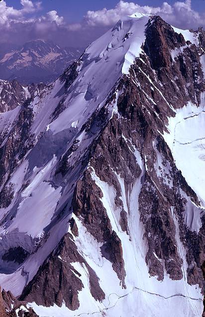
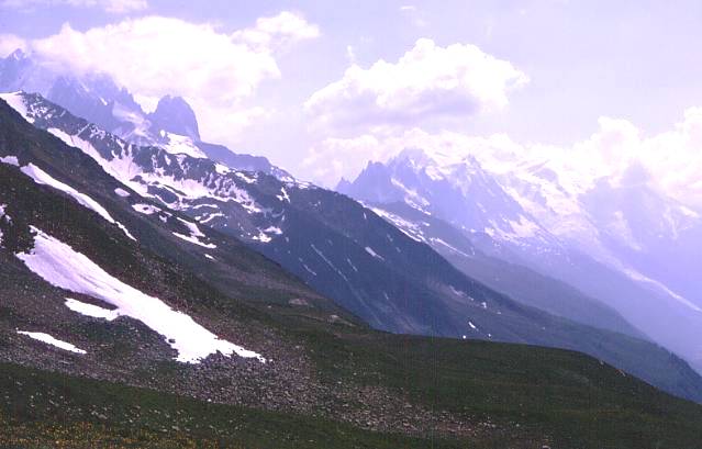
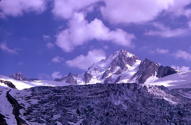
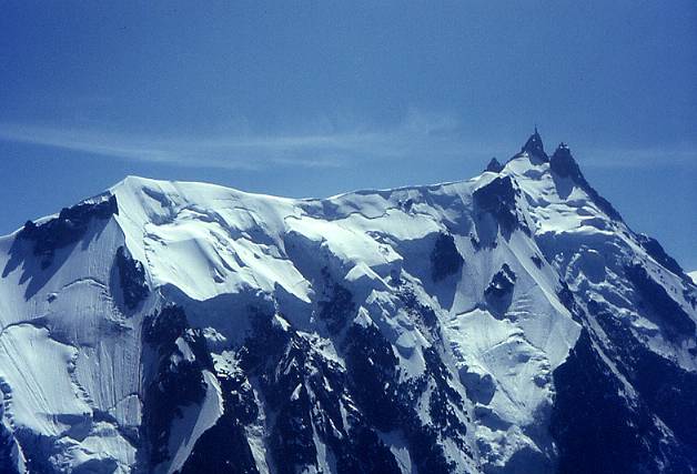
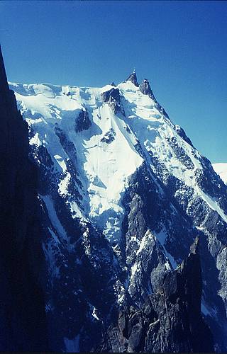
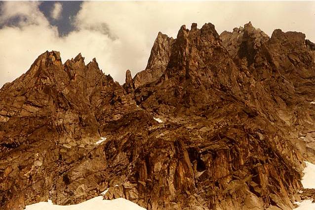
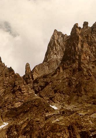
we all scurried back to the Albert 1er. The prime peak in the area is the Aiguille
de Chardonnet, just opposite the refuge. Some of our party did the Forbes
Arête, which although rated PD is quite long and serious for the grade.
The route was familiar in the club’s folklore, as one of the members
had lost some toes by frostbite when forced to bivouac in a crevasse on
the descent from this climb a previous year. This story had been told
and retold on numerous Tuesday bar nights and had marked us, especially
as it was difficult not to notice the hand made Lawrie’s boot on his
slightly shorter foot. The other obvious, but harder route, is the North
buttress, which faces the hut and gives a grade D ice climb. I did this
route with my brother Harry and Colin Brown a few years later and some
of the photos included here were taken on this second visit. Curiously I
have none from the 69 trip. Have they been lost, leant or perhaps, at
the time, it didn’t seem important to take any, I have no idea. It was getting to the end of our month but we managed
to fit in one more climb, on the Chamonix Aiguilles once more. As time
was short, Graham, Rich and I decided to break our rule and make use of
modern amenities to do a climb on the Aiguille de
Peigne (the first peak on the rock ridge left of the Aiguille du
Midi), leaving the
valley early in the morning by the first cabin car on the Aiguille du
Midi téléphérique,
and finishing the climb and return to the Biolay the same day. For us,
this seemed quite special but for French climbers, and most others these
days, it is common practice. Anyone who has read as far as this (anyone there?)
will, no doubt, have categorised me as a hopeless conservative, with
masochistic tendencies, but I will aggravate my case further by saying
that I still maintain that the facility provided by these artificial
means for climbers who have not reached a reasonable level of physical
fitness to gain access rapidly to high mountains, is one of the reasons
for the ever increasing number of mortal accidents in the Alps. That fit
climbers use them to save time seems altogether reasonable, but it is
just the long, hard hut slog that enables visiting flabbies like us to
get fit enough and, equally important, acclimatized enough, to render
many climbs possible in reasonable conditions of safety. So having justified our cop-out, back to the story.
Needless to say, we missed the first departure but got onto the second
and were whisked in minutes up a slope that would have taken a couple of
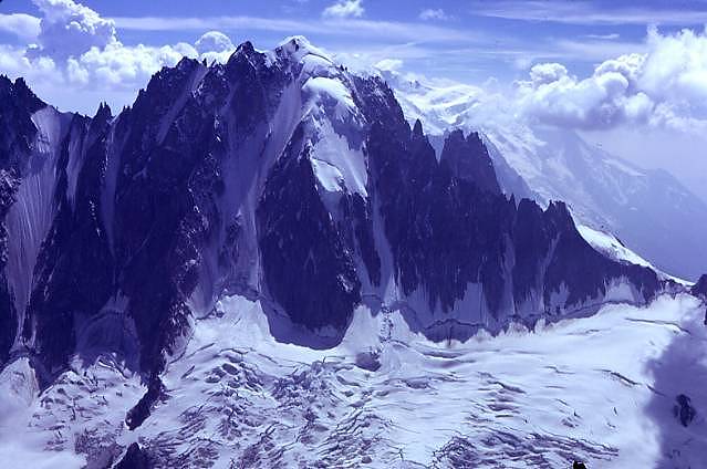
hours on foot. From the Plan de l’Aiguille station we warmed up
quickly walking to the foot of the Papillons Arrête,
(bottom right in photo) wondering why the
hell we hadn’t used these cable cars before. It was a beautiful clear
morning and the cameras were clicking away merrily, the Aiguille du
Midi, seen looking up the Frendo
Spur, received particular attention.
The result is that I have numerous slides of this mountain and none at
all of others, I regret not having forced myself to respect a more
balanced use of film. Another lesson then; avoid the temptation of only
taking the most obvious views, the Petit Dru from Montenvers, for
example, later on the more banal ones are often invaluable for jogging a
fading memory. Of course, at twenty, this kind of consideration didn’t even cross
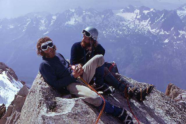
my mind. This is a very popular grade D rock route, which
follows the ridge on clean granite, not very sustained but the views
make up for this. It doesn’t lead to the summit and there is a choice
of routes to finish on. We picked the classic Chamonix
Face, also grade
D. Graham led the famous Lépiney
crack, the crux of the climb,
admiring the two foot long piton that the guides must have put there,
and we were on the summit by midday. It is strange to be half in the
mountains and half in the town. The air is so clear, especially at this
time of day, that all the streets, houses and cars are clearly visible,
the traffic noise can also be heard but this is not really intrusive. It
all seems so domesticated, and yet in a matter of hour, the weather can
change, and the spot where we were sitting, a natural lightning
conductor, become one of the most dangerous places in the massif. We soon set off down, onto the screes, past the lake at Plan de l’Aiguille and then, for the last time that year, back through the grassy meadows and pine woods that lead directly down to the Biolay.
The holiday was over, and it had certainly been a good one, but it was
just the first of many visits. The walk back from town, in front of the
SNCF station , across the foot
bridge over the railway, past the Montenvers station, the sandy car park
and up that rutted track to the Biolay are as familiar in my mind,
sounds, odours and all, as walking from my front door to the letter
boxes at the end of the street a few minutes ago.... I know which walk I
prefer. |
|
|
|
|
|